From traditional land surveying to advanced Aerial mapping,
we cover every angle of your geospatial needs. Our comprehensive surveying services in Sri Lanka are designed to meet the diverse requirements of property owners, developers, government agencies, and construction companies. With a focus on accuracy, efficiency, and innovation, we deliver reliable results that support informed decision-making and successful project outcomes.
Land Surveying
Boundary surveys, Topographic surveys, and Construction staking with
high precision instruments. Our land surveying services provide the foundation for property development, legal documentation, and dispute resolution across Sri Lanka. Using advanced GPS and total station technology, we ensure millimeter-level accuracy for all your surveying needs.
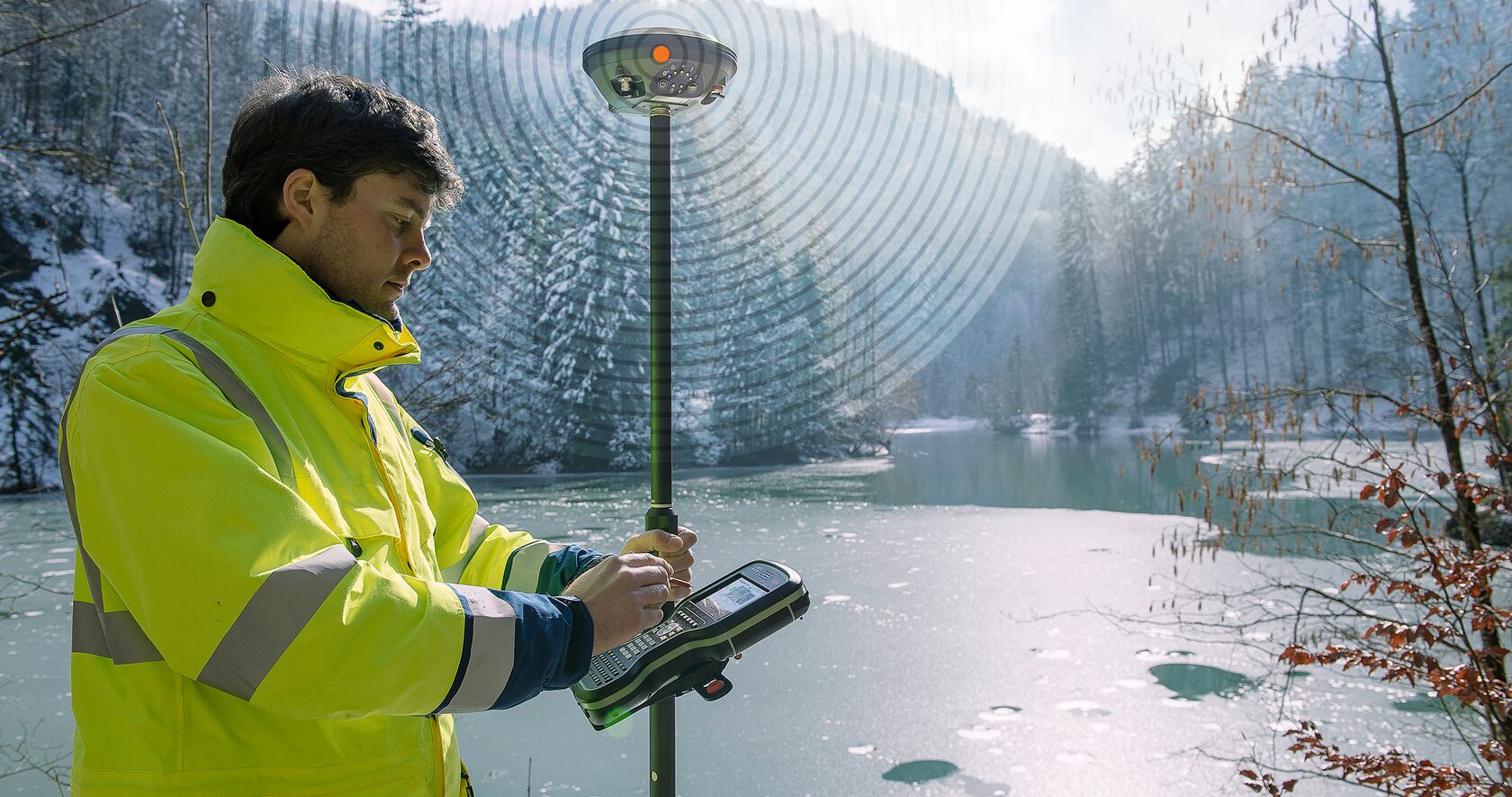
Advanced GPS solutions for large scale mapping projects and geodetic
control networks. Our GPS mapping services utilize Real-Time Kinematic (RTK) GPS technology to achieve centimeter-level accuracy, making them ideal for engineering projects, cadastral mapping, and geospatial data collection throughout Sri Lanka.
Aerial photogrammetry and LiDAR surveys for rapid data collection over
large areas. Our drone surveying services provide cost-effective alternatives to traditional methods, capturing high-resolution imagery and 3D data for topographic mapping, construction monitoring, and environmental assessments in Sri Lanka's varied terrain.
Discover how our comprehensive land surveying services in Sri Lanka can help you with accurate measurements, legal documentation, and property development.
What is Land Surveying?
Land surveying is the science and art of measuring and mapping the physical features of the earth. In Sri Lanka, where diverse terrain and complex property laws exist, professional land surveying services are essential for property owners, developers, and government agencies. Our team of licensed surveyors uses state-of-the-art equipment to provide precise measurements that stand up in court and support your development projects.
Types of Land Surveys We Offer
Boundary Surveys: Establish property lines and resolve disputes
Topographic Surveys: Map elevation and natural features
Construction Staking: Mark exact locations for building projects
As-Built Surveys: Document completed construction
Floodplain Surveys: Assess flood risk areas
Why Choose Professional Land Surveying?
Inaccurate surveys can lead to costly mistakes, legal disputes, and project delays. Our land surveying services in Sri Lanka ensure that your property boundaries are clearly defined, your construction projects are built on solid foundations, and your investments are protected. With over a decade of experience serving clients across the island, we understand the unique challenges of Sri Lankan terrain and regulatory requirements.
Our Land Survey Process
We begin with a thorough site assessment, followed by precise measurements using GPS and total station technology. Our surveyors analyze the data, create detailed maps and reports, and provide clear explanations of our findings. All work is backed by professional liability insurance and meets Sri Lankan surveying standards.
Whether you're buying land, planning construction, or resolving property disputes, our land surveying services provide the accurate information you need to make informed decisions and protect your interests.
Engineering Survey Services in Sri Lanka
Our engineering survey services support infrastructure development, construction projects, and urban planning across Sri Lanka with precision and expertise.
What Are Engineering Surveys?
Engineering surveys provide the spatial data and measurements needed for planning, designing, and constructing infrastructure projects. In Sri Lanka's growing economy, these surveys are crucial for roads, bridges, buildings, utilities, and environmental projects. Our engineering survey services combine traditional surveying techniques with modern technology to deliver accurate data for complex engineering challenges.
Our Engineering Survey Capabilities
Route Surveys: For highways, railways, and pipelines
Construction Layout: Precise positioning for buildings and infrastructure
Volume Calculations: Earthwork and material quantity assessments
Monitoring Surveys: Track structural movements and settlements
We employ cutting-edge surveying technology including robotic total stations, GPS systems, laser scanners, and drone mapping to collect data efficiently and accurately. Our engineering survey services in Sri Lanka are designed to meet international standards while adapting to local conditions and regulations.
Engineering Survey Applications
Our services support a wide range of engineering projects including:
Road and highway construction
Bridge and tunnel projects
Building construction and renovation
Water supply and irrigation systems
Power line and telecommunication infrastructure
Mining and quarry operations
With our engineering survey expertise, we help ensure that your projects are built on accurate foundations, meet regulatory requirements, and are completed on time and within budget.
Geospatial Mapping Solutions
Transform spatial data into actionable insights with our comprehensive geospatial mapping services tailored for Sri Lanka's diverse landscapes.
GIS Mapping
Geographic Information Systems (GIS) mapping integrates spatial data with attribute information to create powerful analytical tools. Our GIS mapping services help organizations visualize patterns, analyze trends, and make data-driven decisions.
• Land use planning
• Environmental monitoring
• Resource management
• Urban development
Digital Terrain Modeling
Create accurate 3D representations of terrain and surfaces using advanced surveying techniques. Our digital terrain models support engineering design, flood analysis, and environmental planning.
• Contour mapping
• Slope analysis
• Volume calculations
• Visual impact studies
Remote Sensing & Imagery
Utilize satellite imagery, aerial photography, and LiDAR data for large-scale mapping projects. Our remote sensing solutions provide cost-effective alternatives to traditional ground surveys.
• Land cover classification
• Change detection
• Agricultural monitoring
• Disaster assessment
Why Choose Our Geospatial Mapping Solutions?
In today's data-driven world, accurate geospatial information is essential for effective decision-making. Our geospatial mapping solutions in Sri Lanka combine traditional surveying expertise with modern technology to deliver comprehensive spatial data products.
We work with government agencies, private companies, and research institutions to create detailed maps and spatial databases that support planning, development, and environmental management initiatives.
Our team uses industry-leading software including ArcGIS, AutoCAD, and specialized geospatial tools to process and analyze spatial data. We ensure that all mapping products meet Sri Lankan coordinate systems and international standards.
Whether you need basic property maps or complex multi-layered GIS databases, our geospatial mapping solutions provide the foundation for informed decision-making and sustainable development.
Why Choose Geo Lanka Survey Solutions
1
Licensed Professionals
Our team consists of government licensed surveyors with years of
field experience in Sri Lanka's diverse terrain and regulatory environment.
2
Modern Equipment
We use the latest Total Stations, GPS units, and Drones for
pinpoint accuracy, ensuring reliable results in challenging conditions.
3
Fast Turnaround
Get your survey plans and reports delivered quickly without
compromising quality, helping you meet project deadlines.
4
Local Expertise
With deep knowledge of Sri Lankan geography, laws, and customs, we provide culturally sensitive and legally compliant surveying services.
5
Comprehensive Solutions
From initial consultation to final deliverables, we offer end-to-end surveying solutions that cover all your geospatial needs.
Choose Geo Lanka Survey Solutions for reliable, accurate, and professional surveying services that drive your projects forward with confidence.
Contact Us
Ready to start your surveying project? Get in touch with our experts for a free consultation and quote.